CA Licensed PLS #8099 | Calabasas, CA

June 6, 2026
If you are involved in acommercial real estate transaction, a land acquisition, or a title insurancematter, there is a good chance your next land title survey will need to comply with the 2026 ALTA/NSPS Land Title Survey Standards. These standards tookeffect February 23, 2026, replacing the 2021 edition that had governed theindustry for the previous five years.
For surveyors, title companies,real estate attorneys, lenders, and developers, the 2026 update is not awholesale rewrite — but it does introduce meaningful changes, particularly in Table A and in how surveyors must document and communicate findings. Understandingthese changes matters for anyone who orders, reviews, or relies on an ALTA/NSPSLand Title Survey.
This article explains what the2026 ALTA/NSPS Standards are, what changed from 2021, why Table A items matter, and what these revisions mean in practice.
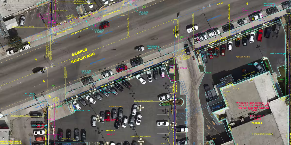
The ALTA/NSPS Land Title Survey Standards are a nationally uniform set of minimum requirements jointlypublished by the American Land Title Association (ALTA) and the NationalSociety of Professional Surveyors (NSPS). They govern how licensed surveyors mustconduct, document, and certify a specific type of commercial real estate surveyknown as an ALTA/NSPS Land Title Survey — sometimes called simply an ALTAsurvey.
Unlike a basic boundary survey,an ALTA/NSPS Land Title Survey is designed to satisfy the requirements of title insurance companies, lenders, and sophisticated buyers in commercial andinstitutional real estate transactions. The survey must address boundarylocation, improvements, easements, rights of way, utilities, access,encroachments, and other conditions that could affect title or the use of aproperty.
A complete ALTA/NSPS Land Title Survey consists of four components:
• Fieldwork performed in accordance with Section 5 of the standards
• A plat or map prepared in accordance with Section 6
• Any optional items from Table A requested by the client
• A certification in the form prescribed by Section 7
The standards set minimum performance requirements. They do not replace applicable state law or localsurvey regulations. Where the ALTA/NSPS standards and a jurisdictionalrequirement conflict, the more stringent standard applies.
The 2026 edition retains thesame overall structure as the 2021 standards — eight numbered sections followed by Table A. Most of the core fieldwork and plat requirements are carriedforward with clarifications and minor editorial changes. The most significantpractical changes involve Table A, which was reorganized and expanded, and theaddition of a new mandatory encroachment summary item.
The following is a section-by-section summary of the notable changes.
The 2021 standards described the fieldwork component as "on-site fieldwork." The 2026 edition simplysays "the fieldwork," dropping the phrase "on-site." Thischange is consistent with the revised Table A Item 15, which more broadlyaddresses the use of imagery and non-ground-based data collection methods. Theword "2021" was also removed from the phrase "A complete2021 ALTA/NSPS Land Title Survey includes," making the language version-neutral.
The surveyor's request language was updated to require that the client specify a "2026 ALTA/NSPS LANDTITLE SURVEY" (previously "2021"). This is a routineversion-year update that changes with each edition.
The definition of Relative Positional Precision was refined for technical clarity. The 2021 versiondefined it as the length of the semi-major axis of the error ellipserepresenting the uncertainty in the position of a monument or witness markingany boundary corner relative to the position of an adjacent monument orwitness. The 2026 version reframes the definition as the error ellipse of theline connecting adjacent monuments or witnesses marking boundary corners. Thepractical meaning and the allowable tolerance — 2 cm (0.07 feet) plus 50 partsper million — remain unchanged.
The 2026 version also removes the phrase "or approximately 2 standard deviations" from thedescription of the 95 percent confidence level, simplifying and clarifying thelanguage without changing the standard.
The 2021 edition included a requirement that the surveyor be provided with current record descriptions ofany adjoining properties ("adjoiners"), except where those adjoiningproperties were lots in a platted, recorded subdivision. The 2026 editionremoves this as a standard document requirement. The adjoiner descriptionrequirement, which was sometimes impractical to fulfill in densely developedareas, is no longer listed among the documents the surveyor must receive.
Additionally, the 2021 language stated the surveyor "will" be provided with appropriate data; the2026 version uses the stronger term "must," reinforcing that properdocument delivery is a prerequisite for survey performance.
The 2021 standards stated the survey must be performed "on the ground" (except as otherwisenegotiated under Table A Item 15). The 2026 edition replaces this with the moregeneral requirement that fieldwork must be performed "using practicesgenerally recognized as acceptable by the surveying profession." Thischange better accommodates modern data collection methods, including aerialmapping, mobile LiDAR, and other remote sensing technologies, without requiringa specific Table A negotiation for every non-traditional methodology.
In Section 5.B.iii, the phrase"Visible evidence" of physical access was changed to "Evidence," removing the modifier. This is a minor but meaningfulclarification - physical access conditions are to be reported based on evidenceobserved in the fieldwork, whether or not they are visually obvious.
In Sections 5.C.i and 5.E.iv, the word "adjoiners" was updated to "adjoining properties,"standardizing the terminology used throughout the document.
Section 6.C.vi updated the reference for adjoining non-platted properties from "non-platted adjoiningland" to "non-platted adjoining properties," and similarlyupdated references to "public records" to "tax records."These are terminology standardizations.
Section 6.C.viii updated theinsurer release language. The 2021 version referred to the insurer providing "evidence of a release of" an easement; the 2026 version says"evidence that the easement has been terminated or extinguished" - more precise language that describes the actual legal conditions under which aneasement ceases to burden a property.
Section 6.D.ii.(g) was updated to reflect the renumbering of Table A items. The reference now reads"21(a), 21(b), 21(c)" for custom items (previously "20(a),20(b)"), consistent with the expansion of the standard Table A items from19 to 20.
Section 6.D.ii.(l) is new to the2026 edition. It adds a required plat notation: "Notation of any parol statements by interested landowners or occupants as to title or boundary issuesrelating to the surveyed property." This is a new mandatory disclosurerequirement - if any person with an interest in the property makes oralstatements to the surveyor regarding title or boundary during fieldwork, thosestatements must be noted on the face of the plat or map.
Section 6.D.iii was updated to change "state statutes" to "state statute" and "localordinances" to "local ordinance" — grammatical corrections withno substantive effect.
The 2021 version stated that ifthe surveyor is required to record or file a plat, it "shall" be sorecorded. The 2026 edition replaces "shall" with "must,"consistent with a broader editorial shift throughout the document toward more unambiguous mandatory language.
Table A is the section of theALTA/NSPS standards that allows clients to customize the scope of an ALTA survey beyond the minimum requirements. Understanding Table A is critical foranyone ordering or reviewing an ALTA survey, because selected items directlyaffect survey cost, survey scope, fieldwork complexity, and the informationshown on the plat.
The ALTA/NSPS standardsestablish a baseline of what every ALTA survey must include: boundary locationand closure, rights of way and access, visible improvements, evidence ofeasements and servitudes, utilities visible on or above the surface, and other features enumerated in Sections 5 and 6. These are not optional — they are thefloor.
Table A items go beyond thatfloor. They are optional items negotiated between the surveyor and client. Whena Table A item is selected and checked, the surveyor becomes responsible for performing and documenting the work described by that item. The fee forselected items is negotiated separately from the base survey fee.
The 2021 Table A contained 19numbered items, with a blank Item 20 for custom additions negotiated between the surveyor and client. The 2026 Table A expands to 20 standard items, withthe blank custom item slot moving to Item 21. Items 1 through 19 are carriedforward from 2021, with the notable modifications. Item 20 isentirely new and substantive.
Item 15 underwent significantrevision. In 2021, it addressed a broad range of technologies — "rectifiedorthophotography, photogrammetric mapping, remote sensing, airborne/mobilelaser scanning and other similar products, tools or technologies" — asmethods for showing the location of certain non-boundary features where ground measurements were not required.
The 2026 version narrows and reorganizes this item. The broad technology list is replaced with the simplerterm "imagery," and the item now explicitly applies to features otherthan the boundary survey portion and features in close proximity to a boundaryor relevant setback line. Most importantly, the 2026 version adds a newrequirement not found in 2021: the surveyor must agree with the client inwriting on the specific imagery to be used, including its source, date and/orversion, and any applicable licensing costs and requirements.
This change reflects the increasing use of commercial aerial and satellite imagery in survey practice and adds a layer of transparency and client consent that was absent before.
Item 11(b) was revised to clarify that a private utility locate request may be coordinated by either the surveyor or the client. The 2021 version referred only to markings coordinatedby the surveyor. This is a practical acknowledgment that in many transactions,the client or their contractor arranges the utility locate independently, andthe surveyor incorporates the resulting information into the survey.
This is the most substantive newaddition to the 2026 standards. When Item 20 is selected, the surveyor must prepare a tabular summary of identified encroachments and site conditions, placed on the face of the plat or map. The table must identify physical conditions observed during fieldwork or identified during plat preparation, andprovide a means for a reviewer to locate those conditions on the plat.
The conditions required to be summarized include:
• Potential encroachments over boundary lines — from adjoining property onto the surveyed property, and from the surveyed propertyonto adjoining property
• Potential encroachments into rights of way and easements (where documentation was provided)
• Potential encroachments of front, side, or rear setbacks (where setback requirements were provided via Item 6(a) or 6(b), or inrecorded documents)
• Physical access between adjoining parcels without benefit of a documented easement
• Use of adjoining parcels by apparent occupants of the surveyed property without benefit of a documented easement
The standard explicitly states that this table does not express a legal opinion as to ownership or the nature of any encroachment, and that it may not be a comprehensive list of allconcerns shown on the plat. Its purpose is to create a structured, scannable reference tool — a checklist of potential title and encroachment issues — forreviewers including title officers, attorneys, and lenders.
Item 20 is optional and negotiated. However, for complex commercial properties — multi-tenant buildings, properties with shared walls, projects with tight setbacks, or siteswhere encroachment issues are suspected — selecting Item 20 adds significantvalue to the survey deliverable.
Any ALTA/NSPS Land Title Survey commencing on or after February 23, 2026 must comply with the 2026 standards. The certification language on the plat or map must reference the 2026 Minimum Standard Detail Requirements. Using a 2021 certification on a new survey would be technically non-compliant.
Surveyors should update their standard scope of work templates, proposal language, and Table A checklists toreflect the 2026 numbering. The addition of Item 20 as a new encroachmentsummary option provides an opportunity to offer a higher-value deliverable toclients, particularly for urban infill projects, multi-parcel assemblages, and properties with complex boundary histories.
The removal of the adjoiner description requirement from Section 4 reduces one administrative burden, particularly in jurisdictions where obtaining current legal descriptions for all adjacent parcels was time-consuming.
Surveyors should also note the new requirement in Section 6.D.ii.(l) to document any parol statements made by landowners or occupants regarding title or boundary issues. This is a fieldwork and documentation habit that must be formalized — conversations with property owners that touch on boundary or title should be noted and disclosed on the plat.
Title officers and attorneys reviewing ALTA surveys should confirm that surveys ordered on or after February23, 2026 bear the 2026 certification. A survey certified to the 2021 standardsis not necessarily deficient if the survey was contracted and performed beforethe effective date, but any new survey should reflect the current version.
The new Item 20 encroachment summary table, when selected, creates a more readily accessible summary of potential issues for title review. This can streamline the process of identifying survey exceptions and evaluating the scope of coverage to be provided.
The updated easement release language in Section 6.C.viii - requiring evidence that an easement "hasbeen terminated or extinguished" rather than merely evidence of a"release" - aligns more precisely with title insurance underwritingstandards and the legal conditions under which an easement actually ceases toburden a property.
Developers and design professionals who rely on ALTA surveys for due diligence and site planningshould be aware that the 2026 standards afford more flexibility in hownon-boundary features are captured. The updated Item 15 allows forimagery-based data collection for features away from the boundary, subject to a written agreement on imagery source and licensing. On large or complex sites,this can reduce cost and accelerate delivery of survey data for use in site planning and design.
The new encroachment summary table (Item 20) is particularly valuable early in due diligence. Selecting this item can surface boundary, setback, and access issues in a structured formatbefore design work begins - potentially avoiding costly surprises later inentitlement or construction.
Property owners and their lenders who routinely order ALTA surveys in connection with acquisitions or refinancing should ensure their survey order letters and title companyrequirements reference the 2026 standards. Most lenders require ALTA surveys to comply with the current standards as a condition of underwriting.
The practical scope of the survey — what is measured, what is shown on the plat, and what optional items are selected - determines the cost and the utility of the survey. Selecting the right Table A items for a given transaction is a conversation worth having with your surveyor before the survey is ordered.
The 2026 ALTA/NSPS Land TitleSurvey Standards represent a focused update to an already mature andwell-structured set of requirements. The core structure, measurement standards, fieldwork requirements, and plat content rules are substantially preserved from2021. The most meaningful changes are:
• Table A now contains 20 standard items (up from 19),with custom items now identified as 21(a), 21(b), etc.
• Item 20 is a new optional encroachment and siteconditions summary table — a structured, reviewer-friendly disclosure tool onthe face of the plat
• Item 15 (imagery/remote sensing) was rewritten to focuson imagery specifically and adds a new written client agreement requirement forimagery source and licensing
• Item 11(b) was clarified to allow utility locatecoordination by either the surveyor or the client
• The adjoiner description requirement was removed fromSection 4
• Parol statements by landowners or occupants regardingtitle or boundary are now required to be noted on the plat (Section 6.D.ii.(l))
• "Shall" replaced by "must" inmandatory provisions, strengthening the obligatory character of certainrequirements
• Fieldwork is no longer restricted to "on theground" methods — recognized professional practices encompassing moderndata collection technologies are accepted
For commercial real estate professionals in Southern California and across the country, the message is straightforward: any ALTA survey ordered now should reference and comply with the 2026 ALTA/NSPS Land Title Survey Standards. If you have questions aboutscope, Table A item selection, or how these standards apply to a specificproperty, consult with a licensed professional land surveyor experienced in ALTA survey work.